Buy or check tickets on the official Banff Gondola site before you go. If parking stress matters, use Roam Route 1 or the official same-day ticket shuttle option. Plan 2-3 hours for the ride, summit building, boardwalk/viewpoints, photos, washroom stop, and food if you eat at the top.
Map first: where it is and how you get there
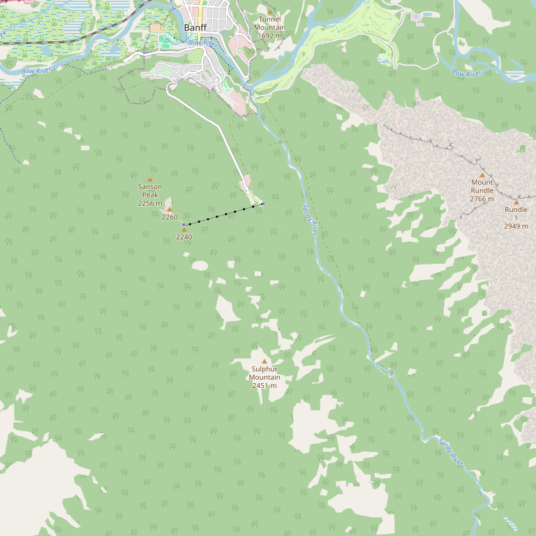
The lower terminal is at the end of Mountain Avenue at the base of Sulphur Mountain. Driving is simple on the map, but parking can be limited. Roam Route 1 serves the Sulphur Mountain area year-round according to official Banff Gondola guidance.
How the stop is shaped
This is the simple mental map: downtown Banff -> Mountain Avenue -> lower terminal -> 8-minute gondola ride -> summit building -> boardwalk toward Sanson Peak.
The green map is an actual OpenStreetMap view. The simple model below is for planning and storytelling. Use Google/Apple Maps for live navigation and the official site for current closures, hours, and shuttle details.
Use this if you have mobility constraints, a family load, or a schedule that does not fit transit. Check parking risk before committing.
Use Roam Route 1 from downtown Banff when you want to avoid parking and downtown car movement.
Tickets, price, and booking
Ticket prices, child/family rules, taxes, packages, and time slots change. The useful rule is: check the official ticket page first, then decide whether the weather and your day plan justify the cost.
Clear weather, first Banff visit, family/group wants a reliable big view, or you want a summit dining/photo moment.
Low cloud, wildfire smoke, tight budget, or you already have a strong viewpoint planned.
What do you actually do at the top?
Do not think of the gondola as only "ride up, take one photo, ride down." The summit is the main product: observation decks, the Above Banff Interpretive Centre, food, washrooms, gift shop, rooftop views, and the boardwalk toward Sanson Peak.
Warm indoor reset, exhibits, theatre/interpretive content, washrooms, food decisions, and rooftop viewpoint.
An easy ridge walk toward Sanson Peak. Banff & Lake Louise Tourism describes it as about 500m to Sanson Peak.
Historic weather observatory / Cosmic Ray Station area and a different angle over Banff and the Bow Valley.
If tired or cold, stay inside the summit building, use the observation areas, eat, warm up, then go back down.

How long should you plan?
Parking, shuttle/bus arrival, ticket scan, washroom if needed.
Cabin ride and first photos. Keep the phone ready before boarding.
Observation levels, exhibits, gift shop, washrooms, and food decisions.
Walk toward the Sanson's Peak side viewpoint if weather, footwear, and mobility fit.
Eat at the summit, take final photos, then ride down before closing/last download constraints.
Treat this as planning time, not a promise. Lines, food reservations, weather, and group pace change the visit.
What you can see and photograph
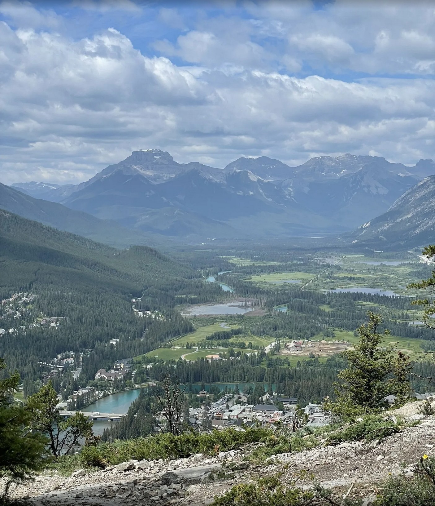
The main value is the high view over Banff, the Bow Valley, surrounding peaks, and the feeling of being above town. Use the summit as a story sequence: lower terminal, cabin ride, first reveal, boardwalk, meal/rest, final view.
Stand back far enough to show the cable rising into the mountain. This sets up the story before the ride.
Put the cable line or window frame in the photo so viewers understand you are moving upward.
Put one person small in the frame, with the valley and town behind them. Avoid only taking close-up selfies.
If clouds hide the far view, photograph boardwalk, cabin, hands on railing, warm drink, or the story of the weather.
Food, restaurants, and washrooms
The summit area has dining options listed by the official Banff Gondola site, including Sky Bistro, Northern Lights Alpine Kitchen, and seasonal/limited options such as Peak Patio when operating. Hours and closures change, so always check the official dining page before building dinner around it.
Best for a more intentional mountain-top meal. Reserve/check availability if the meal is the point of the visit.
Useful when you want food at the top but not necessarily a full fine-dining plan.
Good for kids, budget control, and weather delays. Follow site rules and avoid relying on one food option being open.
Use the summit building, dining areas when seated, observation areas, and indoor spaces before/after the boardwalk.
Washroom rule: use lower terminal or summit building facilities before starting the boardwalk. Do not wait until someone is already uncomfortable.
Season and weather: what changes
Mixed snow/mud feel, changing closures, strong weather swings. Bring layers.
Best long-day visibility but busiest. Book earlier and consider transit.
Cooler air, good light, faster weather change. Watch last ride up/down times.
Cold summit, snowy boardwalk conditions, dramatic views when clear. Footwear matters.
Check the live webcam before you buy if visibility is the main reason you are going. A cloudy summit can still be memorable, but it is a different product than a clear panorama.
What to bring
- Park pass if you are visiting/stopping in Banff National Park.
- Ticket confirmation and reservation details if booked.
- Warm layer; summit weather can feel colder than downtown.
- Comfortable shoes for the boardwalk/viewpoint section.
- Water, small snack, sunglasses/sunscreen, and phone battery.
- Camera plan: wide valley shot, cabin ride shot, person-in-frame shot, food/rest shot.
Turn this point into a photo story
This is a perfect first sample for the memory movie product. A visitor can upload 4-8 photos: lower terminal, cabin ride, first summit view, boardwalk, meal, and ride down. The page can place each photo on this mini-map and produce a 15-30 second vertical story.
Arrive at 100 Mountain Ave.
Cabin leaves the lower terminal.
First summit reveal.
Food, boardwalk, or final view.
Official sources and live links
Images shown here are planning references. Official hours, pricing, closures, restaurants, and route schedules are live-changing facts; use the linked operator and transit pages before booking or traveling.